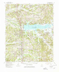
1954 Map of Oakland
USGS Topo · Published 1980About this map
Enid Lake dominates the central landscape of this North Mississippi survey, representing a significant post-war hydraulic transformation of the Yocona River valley. The Enid Dam at the western edge of the reservoir holds back waters that submerged portions of the river plain, though the surrounding hills remain dotted with small rural communities and institutions. To the north and south, the Illinois Central railroad corridor anchors the primary settlements of Courtland, Pope, and Oakland, tracing a historic transportation spine through the region. This 1954 mapping period captures the rural social infrastructure of the day, including Hubbard Chapel Sch and Oliver Ray Sch & Ch. The map is particularly rich in genealogical data, preserving the locations of numerous family-named landmarks and country churches such as Old Bynum Cem, Philadelphia Ch, and the Persimmon Hill Sch & Cem, which offer a detailed look at the cultural footprint of Yalobusha County before modern consolidation.
Find a feature on this map
146 named features on this map. Tap any name to fly to it.
Don’t see what you’re looking for? This feature index may not catch every label — zoom into the map to look around manually.
Map Details
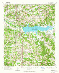
Editions of this 1954 Oakland Map
3 editions found

Other maps of this area

1932 · Sledge
USGS Topo · 1:48,000

1932 · Philipp
USGS Topo · 1:48,000

1935 · Crowder
USGS Topo · 1:62,500

1935 · Sledge
USGS Topo · 1:62,500

1935 · Philipp
USGS Topo · 1:62,500

1939 · Sledge
USGS Topo · 1:62,500

1939 · Crowder
USGS Topo · 1:62,500

1939 · Philipp
USGS Topo · 1:62,500

1940 · Oxford
USGS Topo · 1:62,500

1943 · Oxford
USGS Topo · 1:62,500