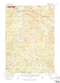
1956 Map of Oakridge
USGS Topo · Published 1960About this map
Oakridge and Willamette City anchor the northwestern corner of this survey, marking a period of significant infrastructure development along the Middle Fork Willamette River. The most striking industrial change is the Hills Creek Dam, then under construction on Hills Creek. This massive engineering project was reshaping the local landscape and hydrology, eventually creating a reservoir where the river once flowed past Sand Prairie.
Find a feature on this map
139 named features on this map. Tap any name to fly to it.
Don’t see what you’re looking for? This feature index may not catch every label — zoom into the map to look around manually.
Map Details
Editions of this 1956 Oakridge Map
3 editions found

Other maps of this area

1917 · Diamond Lake
USGS Topo · 1:125,000

1925 · Waldo Lake
USGS Topo · 1:125,000

1935 · Lowell
USGS Topo · 1:96,000

1942 · Lowell
USGS Topo · 1:125,000

1955 · Hardesty Mtn
USGS Topo · 1:62,500

1955 · Illahee Rock
USGS Topo · 1:62,500

1955 · Fairview Peak
USGS Topo · 1:62,500

1955 · Chucksney Mtn
USGS Topo · 1:62,500

1956 · Toketee Falls
USGS Topo · 1:62,500

1956 · Waldo Lake
USGS Topo · 1:62,500