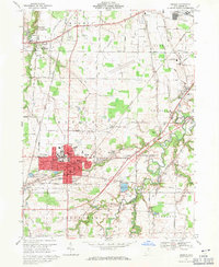
1969 Map of Oberlin
USGS Topo · Published 1971About this map
Oberlin College anchors this late 1960s study of central Lorain County, showing a landscape defined by collegiate expansion, suburban transition, and industrial infrastructure. The red-tinted urban core of Oberlin reveals the concentrated layout of schools and public buildings, including Eastwood Sch and Memorial Hospital, while the surrounding townships of Russia, Amherst, and Carlisle maintain a mix of agrarian plots and active industrial sites like Quarries near South Amherst. Transportation networks are heavily detailed, featuring the Penn Central and Norfolk and Western Railway corridors, as well as the emerging County Airport. Water management is prominent through the Oberlin Reservoir and the winding course of the Black River to the east. Local history is well-preserved in the locations of numerous burial grounds, from the large Westwood Cemetery to smaller sites like Pioneer Cem and Rockwood Cem.
Find a feature on this map
57 named features on this map. Tap any name to fly to it.
Don’t see what you’re looking for? This feature index may not catch every label — zoom into the map to look around manually.
Map Details
Editions of this 1969 Oberlin Map
2 editions found
Other maps of this area

1901 · Oberlin
USGS Topo · 1:62,500

1903 · Vermilion
USGS Topo · 1:62,500

1903 · Oberlin
USGS Topo · 1:62,500

1904 · Wellington
USGS Topo · 1:62,500

1906 · Wellington
USGS Topo · 1:62,500

1908 · New London
USGS Topo · 1:62,500

1953 · Grafton
USGS Topo · 1:24,000

1953 · Avon
USGS Topo · 1:24,000

1956 · Toledo
USGS Topo · 1:250,000

1959 · Vermilion East
USGS Topo · 1:24,000