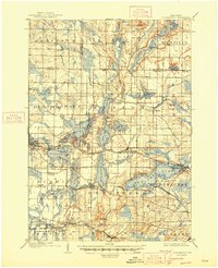
1892 Map of Oconomowoc
USGS Topo · Published 1907About this map
The Oconomowoc River and Bark River systems define this 1890s landscape, connecting a dense network of glacial lakes that would become a premier Midwestern retreat. The Chicago Milwaukee and St. Paul Railroad cuts through the heart of the district, driving the growth of resort-era hubs like Oconomowoc, Hartland, and Nashotah. Local landmarks such as Government Hill and the waters of Pewaukee Lake and Nagawicka Lake are clearly delineated alongside smaller settlements like Monchess and Stone Bank. The mapping captures the area before modern shoreline development, showing the original footprints of communities such as Delafield and Merton as they transitioned from agricultural centers to rail-linked vacation destinations. To the south, the Chicago and North Western Railroad services the hamlets of Dousman and Wales, illustrating the dual-rail economy that shaped Waukesha County at the turn of the century.
Find a feature on this map
62 named features on this map. Tap any name to fly to it.
Don’t see what you’re looking for? This feature index may not catch every label — zoom into the map to look around manually.
Map Details
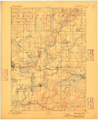
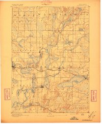
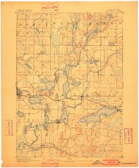
Editions of this 1892 Oconomowoc Map
4 editions found

Historical Maps of Waukesha Through Time
4 maps found