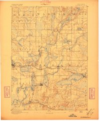
1892 Map of Oconomowoc
USGS Topo · Published 1897About this map
Glacial kettle lakes and terminal moraines dominate this late 19th-century landscape across Waukesha County, where early resort culture and agricultural commerce were firmly established. The Chicago Milwaukee and St. Paul Railroad corridor serves as the primary artery connecting shoreline communities, including Oconomowoc and Pewaukee, to regional markets. This 1890 survey illustrates the dense concentration of water bodies that defined the area's identity, from the prominent Pewaukee Lake to the smaller Genesee Lakes and Silver Lake.
Find a feature on this map
59 named features on this map. Tap any name to fly to it.
Don’t see what you’re looking for? This feature index may not catch every label — zoom into the map to look around manually.
Map Details
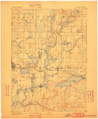
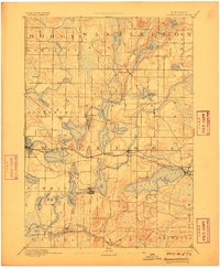
Editions of this 1892 Oconomowoc Map
4 editions found
Other maps of this area

1891 · Muskego
USGS Topo · 1:62,500

1892 · Waukesha
USGS Topo · 1:62,500

1892 · Watertown
USGS Topo · 1:62,500

1892 · Oconomowoc
USGS Topo · 1:62,500

1892 · Whitewater
USGS Topo · 1:62,500

1892 · Eagle
USGS Topo · 1:62,500

1893 · Whitewater
USGS Topo · 1:62,500

1894 · Watertown
USGS Topo · 1:62,500

1894 · Eagle
USGS Topo · 1:62,500

1897 · Eagle
USGS Topo · 1:62,500