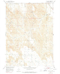
1951 Map of Oconto NW
USGS Topo · Published 1978About this map
The high plateau landscape of Custer County is dominated by prominent geographic benches including Hansen Table and Red Fern Table. This mid-century survey reveals a rural society organized around small district schoolhouses, with Hillside Sch, Hog Hollow Sch, and Cottonwood Sch spaced across the townships of Delight and Grant. The terrain is deeply dissected by drainages such as Cottonwood Creek and Spring Creek, which provided essential water sources in this elevated agricultural region. The far northeastern corner of the map shows the vital transportation corridor of the Union Pacific railroad, which connected these isolated farming tables to larger markets. Dozens of windmills dot the landscape, marking the critical infrastructure required to sustain life and livestock on the Nebraska plains during this era.
Find a feature on this map
14 named features on this map. Tap any name to fly to it.
Don’t see what you’re looking for? This feature index may not catch every label — zoom into the map to look around manually.
Map Details
Editions of this 1951 Oconto NW Map
3 editions found
Other maps of this area

1951 · Callaway SE
USGS Topo · 1:24,000

1951 · Callaway
USGS Topo · 1:24,000

1951 · Oconto SW
USGS Topo · 1:24,000

1951 · Oconto SE
USGS Topo · 1:24,000

1951 · Oconto NW
USGS Topo · 1:24,000

1951 · Oconto
USGS Topo · 1:24,000

1954 · North Platte
USGS Topo · 1:250,000

1955 · Broken Bow
USGS Topo · 1:250,000

1956 · Broken Bow
USGS Topo · 1:250,000

1956 · North Platte
USGS Topo · 1:250,000