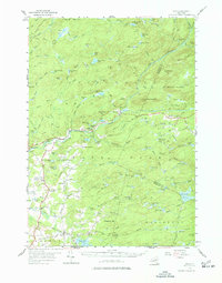
1954 Map of Ohio
USGS Topo · Published 1977About this map
Adirondack State Park dominates this mid-century landscape, characterized by a complex network of wetlands and "vlys" such as Threemile Vly, Whiskey Spring Vly, and Pooler Vly. The settlement at Ohio serves as a local hub, where the Ohio Cem and War Memorial Monument mark the community's history near the West Canada Creek Road. Education in these rural townships was distributed across local institutions like the Wilmurt Sch and Turner Sch, reflecting a time when small schoolhouses still served remote Adirondack foothills.
Find a feature on this map
120 named features on this map. Tap any name to fly to it.
Don’t see what you’re looking for? This feature index may not catch every label — zoom into the map to look around manually.
Map Details
Editions of this 1954 Ohio Map
4 editions found
Other maps of this area

1897 · Remsen
USGS Topo · 1:62,500

1898 · Utica
USGS Topo · 1:62,500

1900 · Little Falls
USGS Topo · 1:62,500

1900 · Utica
USGS Topo · 1:62,500

1900 · Remsen
USGS Topo · 1:62,500

1900 · Canada Lake
USGS Topo · 1:62,500

1900 · Wilmurt
USGS Topo · 1:62,500

1901 · Old Forge
USGS Topo · 1:62,500

1901 · Lassellsville
USGS Topo · 1:62,500

1902 · Wilmurt
USGS Topo · 1:62,500