1953 Map of Okeechobee 4 NW
USGS Topo · Published 1971About this map
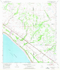
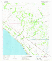
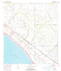
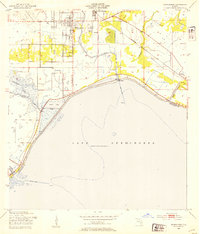
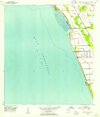
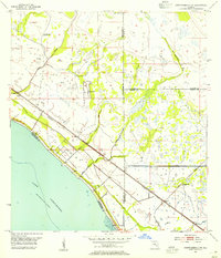
Lake Okeechobee dominates the southwestern corner of this coastal landscape, bordered by a substantial Levee and Spoil Bank system that reflects mid-century water management efforts. The interior is a mosaic of wetlands and sloughs, including Nubbin Slough and Myrtle Slough, which drain toward the massive lake. The infrastructure of the era is clearly defined by the parallel tracks of the Seaboard Coast Line and the Florida East Coast railroads, which cut diagonally across the terrain toward the settlement of Marcy. This 1953 survey, with revisions from 1970, captures the jurisdictional boundaries where Okeechobee, St. Lucie, and Martin Counties converge. Notable drainage features like Van Swearingen Creek, Henry Creek, and Lettuce Creek illustrate the natural hydrology of the region before further modern development.
Find a feature on this map
15 named features on this map. Tap any name to fly to it.
Don’t see what you’re looking for? This feature index may not catch every label — zoom into the map to look around manually.
Map Details
Editions of this 1953 Okeechobee 4 NW Map
4 editions found
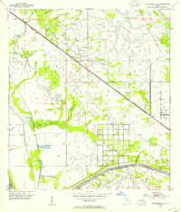
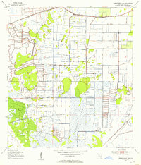
Other maps of this area
1952 · Okeechobee
USGS Topo · 1:24,000
1953 · Okeechobee 4 SW
USGS Topo · 1:24,000
1953 · Okeechobee 4 SE
USGS Topo · 1:24,000
1953 · Okeechobee 1 SE
USGS Topo · 1:24,000
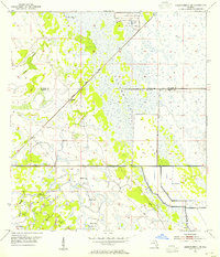
1953 · Okeechobee 4 NE
USGS Topo · 1:24,000
1953 · Okeechobee 4 NW
USGS Topo · 1:24,000
1953 · Okeechobee 1 SW
USGS Topo · 1:24,000
1953 · Taylor Creek SE
USGS Topo · 1:24,000

1956 · Fort Pierce
USGS Topo · 1:250,000

1958 · Fort Pierce
USGS Topo · 1:250,000