
1952 Map of Okeechobee NW
USGS Topo · Published 1954About this map
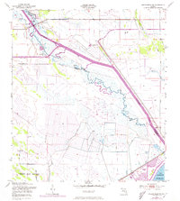
The Kissimmee River meanders toward the southern marshes in this early 1950s survey, showing the complex hydrology before major 20th-century channelization fully altered the landscape. Significant landmarks including a Gaging Station and Flood Gate indicate the burgeoning efforts of the U.S. Corps of Engineers to manage water levels in the region. To the southwest, the Brighton Seminole Indian Reservation occupies a large portion of the territory, while the map records numerous Flowing Wells and Windmills scattered across the terrain.
Find a feature on this map
19 named features on this map. Tap any name to fly to it.
Don’t see what you’re looking for? This feature index may not catch every label — zoom into the map to look around manually.
Map Details
Editions of this 1952 Okeechobee NW Map
3 editions found
Other maps of this area

1952 · Okeechobee
USGS Topo · 1:24,000

1953 · Fort Basinger
USGS Topo · 1:24,000

1953 · Brighton
USGS Topo · 1:24,000

1953 · Brighton SE
USGS Topo · 1:24,000

1953 · Okeechobee SW
USGS Topo · 1:24,000

1953 · Taylor Creek SW
USGS Topo · 1:24,000

1953 · Taylor Creek SE
USGS Topo · 1:24,000

1956 · Fort Pierce
USGS Topo · 1:250,000

1958 · Fort Pierce
USGS Topo · 1:250,000

1959 · Fort Pierce
USGS Topo · 1:250,000