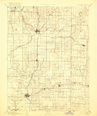
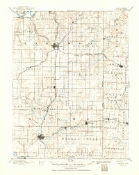
1893 Map of Olathe
USGS Topo · Published 1921About this map
The Kansas Missouri Boundary Line serves as a central axis for this 1880s landscape, illustrating the rapid development of the Border Region before the turn of the century. Large plat-like divisions of civil townships such as Aubry and Springhill define the land, while the grid-based growth of Olathe and Paola highlights their roles as vital transport hubs. The map reveals an intricate web of 19th-century steam travel, with the Kansas City Fort Scott and Gulf Railroad and the Atchison Topeka & Santa Fe Railroad cutting across the prairies.
Find a feature on this map
85 named features on this map. Tap any name to fly to it.
Don’t see what you’re looking for? This feature index may not catch every label — zoom into the map to look around manually.
Map Details
Editions of this 1893 Olathe Map
6 editions found

Other maps of this area

1885 · Garnett
USGS Topo · 1:125,000

1885 · Lawrence
USGS Topo · 1:125,000

1886 · Oskaloosa
USGS Topo · 1:125,000

1887 · Harrisonville
USGS Topo · 1:125,000

1887 · Olathe
USGS Topo · 1:125,000

1887 · Butler
USGS Topo · 1:125,000

1887 · Mound City
USGS Topo · 1:125,000

1888 · Oskaloosa
USGS Topo · 1:125,000

1889 · Lawrence
USGS Topo · 1:125,000

1890 · Kansas City
USGS Topo · 1:125,000