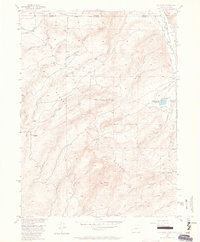
1955 Map of Old Roach
USGS Topo · Published 1964About this map
Old Roach (Aban'd) sits as a quiet mark of past residency on the western edge of this mid-century survey, which straddles the high-country border between Colorado and Wyoming. This landscape is defined by the complex drainage systems of the Laramie River and its numerous tributaries, such as Fish Creek and Stuck Creek. The interplay of state and federal management is visible through the Wyoming-Colorado line and the shared boundaries of the Medicine Bow National Forest and Roosevelt National Forest.
Find a feature on this map
23 named features on this map. Tap any name to fly to it.
Don’t see what you’re looking for? This feature index may not catch every label — zoom into the map to look around manually.
Map Details
Editions of this 1955 Old Roach Map
5 editions found

Other maps of this area

1895 · Laramie
USGS Topo · 1:125,000

1902 · Laramie
USGS Topo · 1:125,000

1905 · Laramie
USGS Topo · 1:125,000

1906 · Medicine Bow
USGS Topo · 1:125,000

1906 · Laramie
USGS Topo · 1:125,000

1908 · Laramie
USGS Topo · 1:125,000

1908 · Medicine Bow
USGS Topo · 1:125,000

1916 · Home
USGS Topo · 1:125,000

1920 · Home
USGS Topo · 1:125,000

1950 · Kings Canyon
USGS Topo · 1:24,000