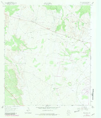
1963 Map of Old X Ranch
USGS Topo · Published 1981About this map
Worsham Ranch and the Old X Ranch anchor this West Texas landscape, defined by the critical infrastructure of water and energy during the early 1960s. The presence of the Worsham Aqueduct, alongside a network of pipelines, Pumping Stations, and Water Tanks, underscores the region's industrial adaptation to an arid environment. Beyond these ranching operations, the map documents the area's subterranean activity with numerous Oil Wells, Gas Wells, and Drill Holes scattered across the terrain.
Find a feature on this map
12 named features on this map. Tap any name to fly to it.
Don’t see what you’re looking for? This feature index may not catch every label — zoom into the map to look around manually.
Map Details
Editions of this 1963 Old X Ranch Map
2 editions found
Other maps of this area

1931 · Barstow
USGS Topo · 1:125,000

1954 · Pecos
USGS Topo · 1:250,000

1957 · Pecos
USGS Topo · 1:250,000

1963 · Ligon Ranch
USGS Topo · 1:24,000

1963 · Old X Ranch
USGS Topo · 1:24,000

1963 · Quito Draw
USGS Topo · 1:24,000

1963 · China Lake
USGS Topo · 1:24,000

1963 · Pecos East
USGS Topo · 1:24,000

1963 · Toyah Lake
USGS Topo · 1:24,000

1970 · Barstow 3 NE
USGS Topo · 1:24,000