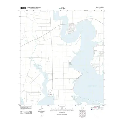
2010 Map of Olivia
USGS Topo · Published 2010About this map
Carancahua Bay and Keller Bay dominate this coastal landscape on the edge of the Gulf of Mexico. The survey documents a series of small waterfront communities and settlements, including Olivia, Port Alto, Carancahua, and Weedhaven. This area is characterized by the meeting of terrestrial and aquatic ecosystems, where Keller Creek and the Fivemile Branch feed into the larger bay systems. The local infrastructure is oriented toward the water, highlighted by the Port Alto Boat Shed Marina and a network of county roads like Calhoun 302 County Rd and Co Rd 301 that connect these remote coastal outposts. To the south, the marshy transition toward the open gulf is marked by Salt Lake and Redfish Lake, showing the complex shoreline before it reaches Cox Bay.
Find a feature on this map
31 named features on this map. Tap any name to fly to it.
Don’t see what you’re looking for? This feature index may not catch every label — zoom into the map to look around manually.
Map Details
Editions of this 2010 Olivia Map
This is the sole edition of this map. No revisions or reprints were ever made.
Other maps of this area

1951 · Keller Bay
USGS Topo · 1:24,000

1952 · Port Lavaca East
USGS Topo · 1:24,000

1952 · Point Comfort
USGS Topo · 1:24,000

1952 · Olivia
USGS Topo · 1:24,000

1952 · Turtle Bay
USGS Topo · 1:24,000

1952 · Francitas
USGS Topo · 1:24,000

1952 · La Ward
USGS Topo · 1:24,000

1952 · Lolita
USGS Topo · 1:24,000

1953 · Beeville
USGS Topo · 1:250,000

1956 · Beeville
USGS Topo · 1:250,000