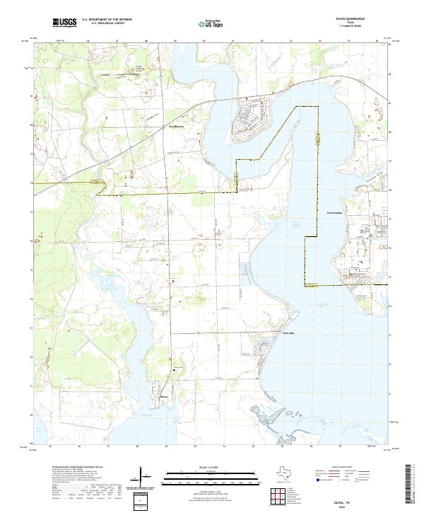
2022 Map of Olivia
USGS Topo · Published 2022About this map
Olivia and Port Alto anchor the shoreline of this coastal Texas region where Keller Bay meets Carancahua Bay. The map reveals a landscape defined by the intersection of Calhoun and Jackson counties, characterized by numerous inlets and coastal drainages like Fivemile Branch and Keller Creek. In the northern section, the settlement of Weedhaven sits near the Shank N Bank Airport, highlighting the area's rural transport infrastructure. Genealogists will find particular value in the location of the Olivia Cem near the southern coast. The presence of Santo Domingo Springs along the western edge of the Carancahua peninsula points to the vital freshwater sources that historically supported these bay-side communities. Residential developments near the water are evidenced by localized street networks, such as those near Carancahua, which contrast with the larger agricultural tracts found further inland.
Find a feature on this map
70 named features on this map. Tap any name to fly to it.
Don’t see what you’re looking for? This feature index may not catch every label — zoom into the map to look around manually.
Map Details
Editions of this 2022 Olivia Map
This is the sole edition of this map. No revisions or reprints were ever made.
Other maps of this area

1951 · Keller Bay
USGS Topo · 1:24,000

1952 · Port Lavaca East
USGS Topo · 1:24,000

1952 · Point Comfort
USGS Topo · 1:24,000

1952 · Olivia
USGS Topo · 1:24,000

1952 · Turtle Bay
USGS Topo · 1:24,000

1952 · Francitas
USGS Topo · 1:24,000

1952 · La Ward
USGS Topo · 1:24,000

1952 · Lolita
USGS Topo · 1:24,000

1953 · Beeville
USGS Topo · 1:250,000

1956 · Beeville
USGS Topo · 1:250,000