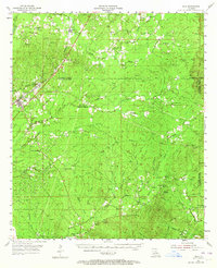
1955 Map of Olla
USGS Topo · Published 1965About this map
Olla and the surrounding piney woods of La Salle and Caldwell Parishes are documented here during the mid-1950s, showing a landscape defined by timber, early rail, and rural church communities. The Missouri Pacific railroad serves as the primary corridor for north-south movement, connecting settlements like Kelly, Standard, and Spaulding. To the east, the terrain becomes increasingly intricate as the land drops toward Funny Louis Bayou and Chickasaw Creek, where a high density of country churches and family cemeteries like Good Hope Cem and Tingle Cem mark the local heritage. A notable feature for historical researchers is the Old Railroad Grade running through the center of the sheet, tracing a path no longer in active rail use by this era. In the south, the community of Summerville and the nearby Gravel Pits suggest the localized extractive industries that supported the region's development alongside traditional agriculture.
Find a feature on this map
75 named features on this map. Tap any name to fly to it.
Don’t see what you’re looking for? This feature index may not catch every label — zoom into the map to look around manually.
Map Details
Editions of this 1955 Olla Map
3 editions found

Other maps of this area

1936 · Pollock
USGS Topo · 1:62,500

1939 · Fort Necessity
USGS Topo · 1:62,500

1940 · Columbia
USGS Topo · 1:62,500

1941 · Manifest
USGS Topo · 1:62,500

1941 · Jena
USGS Topo · 1:62,500

1941 · Pollock
USGS Topo · 1:62,500

1941 · Harrisonburg
USGS Topo · 1:62,500

1953 · Alexandria
USGS Topo · 1:250,000

1953 · Natchez
USGS Topo · 1:250,000

1954 · Sikes
USGS Topo · 1:62,500