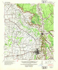
1939 Map of Opelousas
USGS Topo · Published 1954About this map
Opelousas serves as the bustling commercial hub of St. Landry Parish in this pre-war survey, anchoring a landscape where the plantation economy meets emerging industry. The Ville Platte Oil Field at the northern edge marks a significant shift in land use, while established landmarks like the Wartell Plantation reflect the area's agricultural roots. The region is heavily defined by its intricate network of bayous, with Bayou Cocodrie and Bayou Boeuf carving through the terrain, necessitating major crossings like Orbian Bridge and Guillory Bridge.
Find a feature on this map
79 named features on this map. Tap any name to fly to it.
Don’t see what you’re looking for? This feature index may not catch every label — zoom into the map to look around manually.
Map Details
Editions of this 1939 Opelousas Map
2 editions found
Other maps of this area

1935 · Turkey Creek
USGS Topo · 1:62,500

1939 · Opelousas
USGS Topo · 1:62,500

1940 · Arnaudville
USGS Topo · 1:62,500

1947 · Ville Platte
USGS Topo · 1:31,680

1947 · Chataignier
USGS Topo · 1:31,680

1947 · Pitreville
USGS Topo · 1:31,680

1948 · Bunkie
USGS Topo · 1:62,500

1949 · Turkey Creek
USGS Topo · 1:62,500

1952 · Lake Charles
USGS Topo · 1:250,000

1954 · Lake Charles
USGS Topo · 1:250,000