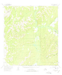
1954 Map of Ophir A-2
USGS Topo · Published 1975About this map
The settlement of Ophir serves as a focal point for this interior Alaskan landscape, situated along the banks of the Innoko River. This 1954 photogrammetric survey reveals an environment defined by its drainage networks and early mining activity. To the west, the prominent elevation of Mount Hurst rises above the surrounding valleys, where numerous waterways like American Creek and Beaver Creek carve through the terrain. Evidence of the region's economic life is found in the east, where a Placer Mine and other Mine labels appear near Ophir Creek. The infrastructure of the era is represented by a Landing Strip and various scattered cabins, illustrating the specialized transportation and residential patterns common to remote mining districts during the mid-century.
Find a feature on this map
26 named features on this map. Tap any name to fly to it.
Don’t see what you’re looking for? This feature index may not catch every label — zoom into the map to look around manually.
Map Details
Editions of this 1954 Ophir A-2 Map
3 editions found
Other maps of this area

1951 · Ophir
USGS Topo · 1:250,000

1951 · Iditarod
USGS Topo · 1:250,000

1954 · Ophir A-2
USGS Topo · 1:63,360

1954 · Ophir A-1
USGS Topo · 1:63,360

1954 · Iditarod D-2
USGS Topo · 1:63,360

1954 · Ophir A-3
USGS Topo · 1:63,360

1954 · Ophir B-1
USGS Topo · 1:63,360

1954 · Ophir B-2
USGS Topo · 1:63,360

1954 · Iditarod D-3
USGS Topo · 1:63,360

1954 · Ophir B-3
USGS Topo · 1:63,360