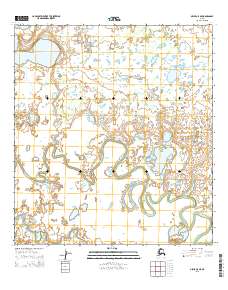
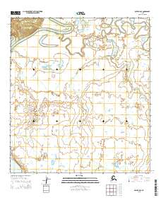
2015 Map of Ophir A-5 NE
USGS Topo · Published 2015About this map
The Iditarod River snakes through this low-lying interior landscape, its tight meanders and numerous oxbow lakes defining the central and southern portions of the terrain. The river's serpentine path is characteristic of the highly active fluvial processes in this part of the Yukon-Koyukuk region, where the water constantly reshapes the valley floor. Historically, this waterway served as a primary transportation artery during early twentieth-century mining booms, though here it is depicted in its modern state within the township boundaries of T26s R3e, T26s R4e, T27s R3e, and T27s R4e. The surrounding land is a complex mosaic of wetlands and small ponds, illustrating the drainage patterns typical of the Alaskan subarctic.
Find a feature on this map
5 named features on this map. Tap any name to fly to it.
Don’t see what you’re looking for? This feature index may not catch every label — zoom into the map to look around manually.
Map Details
Editions of this 2015 Ophir A-5 NE Map
This is the sole edition of this map. No revisions or reprints were ever made.
Other maps of this area

1951 · Ophir
USGS Topo · 1:250,000

1954 · Ophir A-5
USGS Topo · 1:63,360

1954 · Ophir A-4
USGS Topo · 1:63,360

1954 · Ophir B-4
USGS Topo · 1:63,360

1954 · Ophir B-5
USGS Topo · 1:63,360

1954 · Ophir
USGS Topo · 1:250,000
2014 · Ophir B-5 SW
USGS Topo · 1:25,000
2014 · Ophir A-5 NW
USGS Topo · 1:25,000
2015 · Ophir B-4 SW
USGS Topo · 1:25,000
2015 · Ophir B-5 SE
USGS Topo · 1:25,000