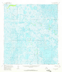
1954 Map of Ophir A-5
USGS Topo · Published 1972About this map
Iditarod River meanders across this interior landscape, defining a complex hydrologic network in the years following mid-century aerial photography. This survey, compiled from 1953 and 1954 photographs, reveals a wilderness dominated by expansive wetlands and shifting watercourses rather than permanent human settlements. The Yetna River flows through the lower half of the quadrangle, eventually meeting larger drainage systems in a region characterized by low relief and high water saturation. A significant landmark in this watery expanse is Sixmile Lake, which provides one of the few large open-water reference points in an area otherwise filled with smaller unnamed ponds. This map captures the region before extensive modern development, showing land lines predetermined by the Bureau of Land Management according to the Kateel River Meridian.
Find a feature on this map
8 named features on this map. Tap any name to fly to it.
Don’t see what you’re looking for? This feature index may not catch every label — zoom into the map to look around manually.
Map Details
Editions of this 1954 Ophir A-5 Map
2 editions found
Other maps of this area

1951 · Ophir
USGS Topo · 1:250,000

1951 · Iditarod
USGS Topo · 1:250,000

1954 · Ophir A-6
USGS Topo · 1:63,360

1954 · Iditarod D-6
USGS Topo · 1:63,360

1954 · Ophir A-5
USGS Topo · 1:63,360

1954 · Iditarod D-5
USGS Topo · 1:63,360

1954 · Ophir A-4
USGS Topo · 1:63,360

1954 · Ophir B-4
USGS Topo · 1:63,360

1954 · Iditarod D-4
USGS Topo · 1:63,360
1954 · Ophir B-6
USGS Topo · 1:63,360