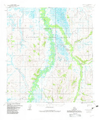
1954 Map of Ophir B-3
USGS Topo · Published 1983About this map
The Innoko River and its meandering tributaries dominate this interior Alaskan landscape, which reflects the early mapping of what became the Innoko National Wildlife Refuge. The map details a complex network of waterways, including the winding course of the Dishna River as it converges with the Innoko. To the east, the terrain rises into the Tolstoi Basin, a region defined by numerous named creeks such as Mastodon Creek, Boob Creek, and Tolstoi Creek. These waterway names often hint at the prospecting and mining history of the Yukon-Koyukuk region. This 1950s-era topographic data, revised in the early 1980s, provides an essential record of the natural hydrology and drainage patterns before later environmental changes, tracing the remote reaches of Madison Creek and Ledge Creek through the wetlands and foothills.
Find a feature on this map
11 named features on this map. Tap any name to fly to it.
Don’t see what you’re looking for? This feature index may not catch every label — zoom into the map to look around manually.
Map Details
Editions of this 1954 Ophir B-3 Map
3 editions found
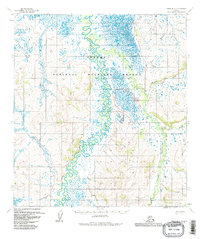
Other maps of this area

1951 · Ophir
USGS Topo · 1:250,000

1954 · Ophir A-2
USGS Topo · 1:63,360

1954 · Ophir C-3
USGS Topo · 1:63,360

1954 · Ophir A-3
USGS Topo · 1:63,360

1954 · Ophir A-4
USGS Topo · 1:63,360

1954 · Ophir B-4
USGS Topo · 1:63,360

1954 · Ophir C-2
USGS Topo · 1:63,360

1954 · Ophir B-2
USGS Topo · 1:63,360

1954 · Ophir B-3
USGS Topo · 1:63,360

1954 · Ophir C-4
USGS Topo · 1:63,360