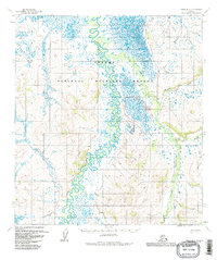
1954 Map of Ophir B-3
USGS Topo · Published 1983About this map
The Dishna River meanders through a vast network of wetlands and oxbow lakes within the Innoko National Wildlife Refuge in this mid-century topographic record. The landscape is defined by the complex hydrology of the interior, where the river's shifting course creates a dense pattern of water bodies and marshland. To the east, the terrain rises toward the Tolstoi highlands, drained by a series of north-flowing tributaries.
Find a feature on this map
12 named features on this map. Tap any name to fly to it.
Don’t see what you’re looking for? This feature index may not catch every label — zoom into the map to look around manually.
Map Details
Editions of this 1954 Ophir B-3 Map
3 editions found
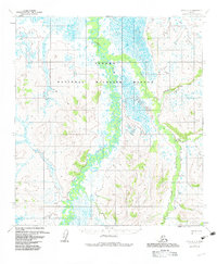
Other maps of this area

1951 · Ophir
USGS Topo · 1:250,000

1954 · Ophir A-2
USGS Topo · 1:63,360

1954 · Ophir C-3
USGS Topo · 1:63,360

1954 · Ophir A-3
USGS Topo · 1:63,360

1954 · Ophir A-4
USGS Topo · 1:63,360

1954 · Ophir B-4
USGS Topo · 1:63,360

1954 · Ophir C-2
USGS Topo · 1:63,360

1954 · Ophir B-2
USGS Topo · 1:63,360

1954 · Ophir B-3
USGS Topo · 1:63,360

1954 · Ophir C-4
USGS Topo · 1:63,360