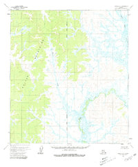
1954 Map of Ophir C-6
USGS Topo · Published 1981About this map
The Kaiyuh Mountains dominate this interior landscape, which was photogrammetrically mapped from aerial photographs taken in 1953. This mid-century survey documents a wilderness defined by its water systems and topographic elevation, where North Hather Creek and Hather Creek drain the eastern lowlands. The survey reflects a period when this part of the Alaskan interior was systematically indexed using the Kateel River Meridian, though the land remained largely unsurveyed and unmarked on the ground. The absence of roads or trails emphasizes the region's character at the time of field annotation in 1954, with drainage from Menolt Creek carving through the western slopes. For researchers, the map provides the exact predetermined township and range locations established by the Bureau of Land Management before physical settlement or transit lines altered the terrain.
Find a feature on this map
5 named features on this map. Tap any name to fly to it.
Don’t see what you’re looking for? This feature index may not catch every label — zoom into the map to look around manually.
Map Details
Editions of this 1954 Ophir C-6 Map
2 editions found
Other maps of this area

1951 · Ophir
USGS Topo · 1:250,000

1951 · Unalakleet
USGS Topo · 1:250,000

1952 · Unalakleet C-1
USGS Topo · 1:63,360

1952 · Unalakleet B-1
USGS Topo · 1:63,360

1952 · Unalakleet D-1
USGS Topo · 1:63,360

1952 · Unalakleet
USGS Topo · 1:250,000
1954 · Ophir D-6
USGS Topo · 1:63,360

1954 · Ophir C-6
USGS Topo · 1:63,360
1954 · Ophir D-5
USGS Topo · 1:63,360

1954 · Ophir C-5
USGS Topo · 1:63,360