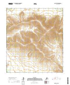
2017 Map of Ophir D-4 NW
USGS Topo · Published 2017About this map
Little Mud River winds through the northern reaches of this interior Alaskan wilderness, as documented in this 2017 study of the Yukon-Koyukuk region. The landscape is defined by the subtle rising elevations of the Flat Hills, where tight contour lines reveal a topography of drainage basins and ridges that feed the river system. The map serves primarily as a record of the Public Land Survey System divisions, clearly delineating townships and ranges such as t17s r5e and t18s r5e. With no roads or settlements indicated, the map captures the remote character of the Yukon-Koyukuk Census Area, focusing on the natural hydrography and the intersection of various township boundaries that define land ownership and management in this part of the state.
Find a feature on this map
11 named features on this map. Tap any name to fly to it.
Don’t see what you’re looking for? This feature index may not catch every label — zoom into the map to look around manually.
Map Details
Editions of this 2017 Ophir D-4 NW Map
This is the sole edition of this map. No revisions or reprints were ever made.
Other maps of this area

1945 · Nulato
USGS Topo · 1:250,000

1951 · Ophir
USGS Topo · 1:250,000

1951 · Nulato
USGS Topo · 1:250,000

1952 · Nulato A-5
USGS Topo · 1:63,360

1952 · Nulato A-4
USGS Topo · 1:63,360

1952 · Nulato
USGS Topo · 1:250,000
1953 · Nulato A-4
USGS Topo · 1:63,360
1954 · Ophir D-4
USGS Topo · 1:63,360
1954 · Ophir D-5
USGS Topo · 1:63,360

1954 · Ophir
USGS Topo · 1:250,000