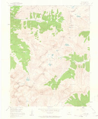
1955 Map of Ophir
USGS Topo · Published 1962About this map
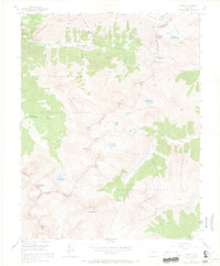
Ophir and the nearby high-altitude settlement at Ophir Loop sit at the center of this 1955 survey of the northern San Juan Mountains. The landscape is defined by its deep mining heritage, showing active operations like the Silver Bell Mine and the Badger Mine, alongside legacy sites such as the Geld King Mine and Suffolk Mine. These claims are tucked into high basins and gulches beneath towering peaks like Silver Mountain and the jagged Ophir Needles. The map details the complex geography where the Uncompahgre National Forest and San Juan National Forest meet, documenting high-alpine features including the Ice Lake Basin and Lake Hope. An Ophir Loop School and an Old AR Grade provide evidence of the social and industrial infrastructure that supported these remote mountain communities during the mid-twentieth century.
Find a feature on this map
64 named features on this map. Tap any name to fly to it.
Don’t see what you’re looking for? This feature index may not catch every label — zoom into the map to look around manually.
Map Details
Editions of this 1955 Ophir Map
7 editions found
Other maps of this area

1897 · Telluride
USGS Topo · 1:62,500

1897 · Silverton
USGS Topo · 1:62,500

1898 · Engineer Mountain
USGS Topo · 1:62,500

1900 · Engineer Mountain
USGS Topo · 1:62,500

1900 · Needle Mountains
USGS Topo · 1:62,500

1901 · Silverton
USGS Topo · 1:62,500

1902 · Needle Mountains
USGS Topo · 1:62,500

1902 · Silverton
USGS Topo · 1:62,500

1904 · Telluride
USGS Topo · 1:62,500

1908 · Engineer Mountain
USGS Topo · 1:62,500