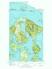
1957 Map of Orcas Island
USGS Topo · Published 1963About this map
Moran State Park dominates the high ground of Orcas Island in this late-1950s record, rising to the summit of Mount Constitution. The island's geography is defined by the deep inlet of East Sound, which nearly bisects the landmass and serves as a focal point for settlements like Rosario and the village of East Sound. The map reveals a landscape of isolated schools and lodges, including Griswold Sch on Shaw Island and Buckhorn Lodge on the northern shore, reflecting the region's mid-century character as a mix of rural homesteads and early recreational retreats.
Find a feature on this map
125 named features on this map. Tap any name to fly to it.
Don’t see what you’re looking for? This feature index may not catch every label — zoom into the map to look around manually.
Map Details
Editions of this 1957 Orcas Island Map
2 editions found

Other maps of this area

1907 · Blaine
USGS Topo · 1:62,500

1943 · Richardson
USGS Topo · 1:62,500

1943 · Orcas Island
USGS Topo · 1:62,500

1943 · Deception Pass
USGS Topo · 1:62,500

1943 · Anacortes
USGS Topo · 1:62,500

1951 · Deception Pass
USGS Topo · 1:62,500

1951 · Anacortes
USGS Topo · 1:62,500

1952 · Lummi Bay
USGS Topo · 1:24,000

1952 · Blaine
USGS Topo · 1:62,500

1954 · Waldron Island
USGS Topo · 1:24,000