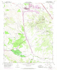
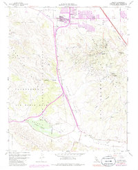
1959 Map of Orcutt
USGS Topo · Published 1968About this map
Orcutt Oil Field and the Casmalia Oil Field dominate this landscape during a period of significant growth and military expansion in Santa Barbara County. The map details the transition from rural ranching to industrial and defense operations, with Vandenberg Air Force Base occupying the western portion of the terrain. Near the community of Orcutt, residential expansion is noted by the purple-tinted urban extensions along Clark Avenue and Bradley Road, while the Union Sch and a local Cemetery remain central to the established settlement.
Find a feature on this map
36 named features on this map. Tap any name to fly to it.
Don’t see what you’re looking for? This feature index may not catch every label — zoom into the map to look around manually.
Map Details
Editions of this 1959 Orcutt Map
5 editions found
Other maps of this area

1905 · Guadalupe
USGS Topo · 1:125,000

1905 · Lompoc
USGS Topo · 1:125,000

1942 · Point Arguello
USGS Topo · 1:62,500

1942 · Guadalupe
USGS Topo · 1:125,000

1942 · Lompoc
USGS Topo · 1:125,000

1942 · Lompoc
USGS Topo · 1:62,500

1942 · Santa Maria
USGS Topo · 1:62,500

1942 · Point Sal
USGS Topo · 1:62,500

1943 · Lompoc
USGS Topo · 1:125,000

1947 · Lompoc
USGS Topo · 1:24,000