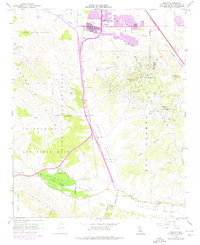
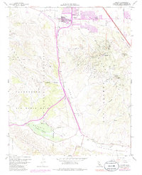
1959 Map of Orcutt
USGS Topo · Published 1976About this map
The Orcutt Oil Field and Casmalia Oil Field dominate this landscape during a period of significant military and industrial overlap in Santa Barbara County. As the community of Orcutt expanded southward, the infrastructure of the petroleum industry met the boundaries of Vandenberg Air Force Base, which occupies a substantial portion of the western terrain through the Casmalia Hills. This 1959 survey, updated with 1974 revisions, reveals the densification of suburban tracts near the Union Sch and along Clark Avenue.
Find a feature on this map
39 named features on this map. Tap any name to fly to it.
Don’t see what you’re looking for? This feature index may not catch every label — zoom into the map to look around manually.
Map Details
Editions of this 1959 Orcutt Map
5 editions found
Other maps of this area

1905 · Guadalupe
USGS Topo · 1:125,000

1905 · Lompoc
USGS Topo · 1:125,000

1942 · Point Arguello
USGS Topo · 1:62,500

1942 · Guadalupe
USGS Topo · 1:125,000

1942 · Lompoc
USGS Topo · 1:125,000

1942 · Lompoc
USGS Topo · 1:62,500

1942 · Santa Maria
USGS Topo · 1:62,500

1942 · Point Sal
USGS Topo · 1:62,500

1943 · Lompoc
USGS Topo · 1:125,000

1947 · Lompoc
USGS Topo · 1:24,000