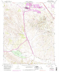
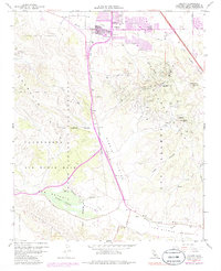
1959 Map of Orcutt
USGS Topo · Published 1984About this map
Orcutt serves as the primary hub of this Central Coast landscape, where residential development and industrial resource extraction meet at the foot of the Solomon Hills. The map details the extensive operations of the Orcutt Oil Field and the Casmalia Oil Field, revealing a dense network of unimproved roads and oil infrastructure sprawling across the hillsides south of the town center. To the west and south, the Vandenberg Air Force Base boundary marks a significant shift in land use, encompassing portions of the Casmalia Hills and the northern reaches of the Purisima Hills.
Find a feature on this map
40 named features on this map. Tap any name to fly to it.
Don’t see what you’re looking for? This feature index may not catch every label — zoom into the map to look around manually.
Map Details
Editions of this 1959 Orcutt Map
5 editions found
Other maps of this area

1905 · Guadalupe
USGS Topo · 1:125,000

1905 · Lompoc
USGS Topo · 1:125,000

1942 · Point Arguello
USGS Topo · 1:62,500

1942 · Guadalupe
USGS Topo · 1:125,000

1942 · Lompoc
USGS Topo · 1:125,000

1942 · Lompoc
USGS Topo · 1:62,500

1942 · Santa Maria
USGS Topo · 1:62,500

1942 · Point Sal
USGS Topo · 1:62,500

1943 · Lompoc
USGS Topo · 1:125,000

1947 · Lompoc
USGS Topo · 1:24,000