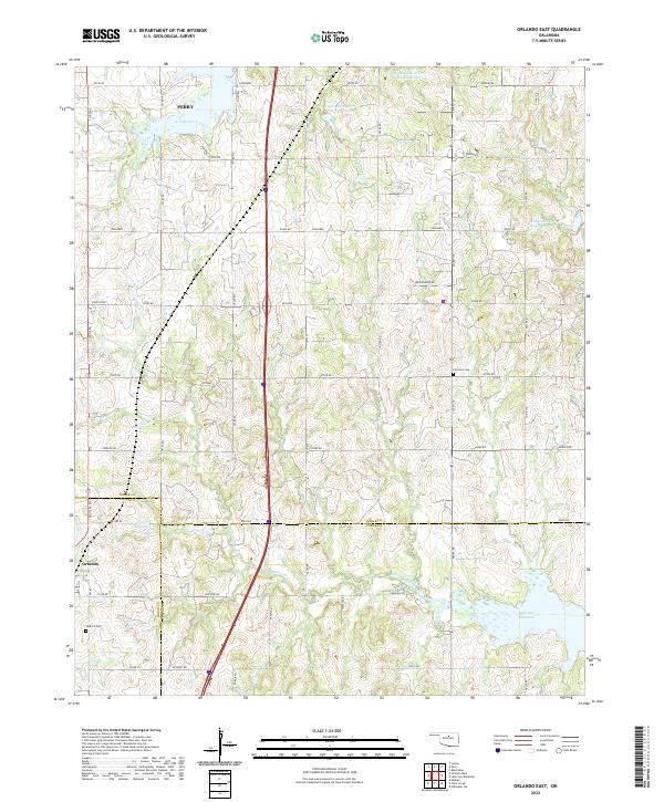
2022 Map of Orlando East
USGS Topo · Published 2022About this map
Orlando sits at the southwestern edge of this landscape where the boundaries of Noble, Logan, and Payne counties converge. The terrain is defined by a dense network of tributaries including Stillwater Creek, Cow Creek, and Little Stillwater Creek, which feed into several engineered water bodies like the northern reaches of Lake Carl Blackwell. This map illustrates the modern transition from agriculture to water management, with numerous reservoirs such as Stillwater Cr Site 43 Reservoir and Upper Black Bear Cr Site 63 Reservoir dotting the drainages.
Find a feature on this map
57 named features on this map. Tap any name to fly to it.
Don’t see what you’re looking for? This feature index may not catch every label — zoom into the map to look around manually.
Map Details
Editions of this 2022 Orlando East Map
This is the sole edition of this map. No revisions or reprints were ever made.
Other maps of this area

1893 · Mulhall
USGS Topo · 1:62,500

1893 · Stillwater
USGS Topo · 1:62,500

1955 · Enid
USGS Topo · 1:250,000

1958 · Enid
USGS Topo · 1:250,000

1966 · Lake Carl Blackwell
USGS Topo · 1:24,000
1967 · Stillwater SW
USGS Topo · 1:24,000

1972 · Perry
USGS Topo · 1:24,000

1972 · Lucien
USGS Topo · 1:24,000
1972 · Black Bear
USGS Topo · 1:24,000
1974 · Mulhall
USGS Topo · 1:24,000