
1946 Map of Orocovis
USGS Topo · Published 1946About this map
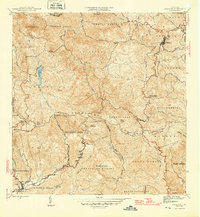
The Cordillera Central dominates this 1940s landscape, serving as the high divide between the northern and southern watersheds of Puerto Rico. Near the center of the sheet, the Capilla de San José and Hacienda Limón sit along the winding slopes, illustrating the traditional agricultural patterns of the interior highlands. To the northwest, the Lago de Matrullas reservoir is fed by the Río Matrullas, a critical water source in a region defined by steep peaks like Cerro Doña Juana and Cerro Mime. In the valley to the southwest, Villalba marks a transition to the coastal drainages of the Río Jacaguas. The map also captures the early presence of utility infrastructure with a prominent Linea de Transmision cutting across the ridges, while the Escuela Segunda Unidad de Bauta serves as a social landmark for the rural communities of the Río Bauta valley.
Find a feature on this map
38 named features on this map. Tap any name to fly to it.
Don’t see what you’re looking for? This feature index may not catch every label — zoom into the map to look around manually.
Map Details
Editions of this 1946 Orocovis Map
3 editions found
Other maps of this area

1945 · Ponce
USGS Topo · 1:30,000

1945 · Rio Descalabrado
USGS Topo · 1:30,000

1946 · Coamo
USGS Topo · 1:30,000

1946 · Corozal
USGS Topo · 1:30,000

1946 · Barranquitas
USGS Topo · 1:30,000

1946 · Ciales
USGS Topo · 1:30,000

1946 · Jayuya
USGS Topo · 1:30,000

1946 · Florida
USGS Topo · 1:30,000

1947 · Corozal SO
USGS Topo · 1:10,000

1947 · Ponce NE
USGS Topo · 1:10,000