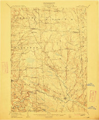
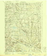
1905 Map of Orwell
USGS Topo · Published 1912About this map
The Salmon River carves a dramatic course through this 1905 survey, anchored by the settlements of Orwell and Redfield. The landscape is defined by the sharp descent of the North Branch Salmon River and the significant drop at Salmon Falls, reflecting the area's transition from the Tug Hill plateau toward the Lake Ontario lowlands. Local history and genealogy researchers will find a dense network of small hamlets and rural crossroads, including Littlejohn Settlement, Beecherville, and Smartville, many of which were centers for the region's timber and early milling industries. The map illustrates the rural character of northern Oswego County just after the turn of the century, with family-named landmarks like Bennett Bridge and Frederick Corners marking the intersections of travel and commerce. Detailed topographic contours reveal the complex drainage systems of Mad River and Sandy Creek, which shaped the placement of early homesteads and community hubs across the towns of Boylston and Redfield.
Find a feature on this map
63 named features on this map. Tap any name to fly to it.
Don’t see what you’re looking for? This feature index may not catch every label — zoom into the map to look around manually.
Map Details
Editions of this 1905 Orwell Map
6 editions found
Other maps of this area

1893 · Sackets Harbor
USGS Topo · 1:62,500

1895 · Sacketts Harbor
USGS Topo · 1:62,500

1895 · Pulaski
USGS Topo · 1:62,500

1895 · Watertown
USGS Topo · 1:62,500

1898 · Watertown
USGS Topo · 1:62,500

1902 · Carthage
USGS Topo · 1:62,500

1903 · Orwell
USGS Topo · 1:62,500

1904 · Carthage
USGS Topo · 1:62,500

1905 · Orwell
USGS Topo · 1:62,500

1905 · Mexico
USGS Topo · 1:62,500