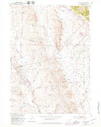
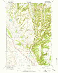
1951 Map of Osage SE
USGS Topo · Published 1979About this map
Energy production and ranching define this landscape in Weston County, where dozens of Oil Wells and a Gas Well are scattered across the arid terrain. The presence of the Hot Artesian Well (Polluted) north of Skull Creek suggests the environmental complexities of early-to-mid century resource extraction. Transportation and industry are anchored by the Burlington Northern railroad corridor in the northeast corner and the winding Morrissey Road to the south.
Find a feature on this map
15 named features on this map. Tap any name to fly to it.
Don’t see what you’re looking for? This feature index may not catch every label — zoom into the map to look around manually.
Map Details
Editions of this 1951 Osage SE Map
4 editions found
Other maps of this area

1899 · Newcastle
USGS Topo · 1:125,000

1901 · Newcastle
USGS Topo · 1:125,000

1951 · Owens
USGS Topo · 1:24,000

1951 · Newcastle
USGS Topo · 1:24,000

1951 · Morrisey NE
USGS Topo · 1:24,000

1951 · Osage SE
USGS Topo · 1:24,000

1955 · Newcastle
USGS Topo · 1:250,000

1958 · Newcastle
USGS Topo · 1:250,000
1958 · Newcastle
USGS Topo · 1:62,500
1972 · Pedro
USGS Topo · 1:24,000