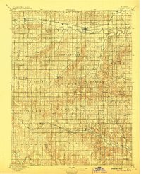
1896 Map of Osborne
USGS Topo · Published 1906About this map
The South Fork Solomon River and North Fork Solomon River dominate the northern landscape of this central Kansas survey, providing the vital water sources that dictated early settlement patterns. Along these corridors, the Missouri Pacific R. R. connects established towns like Alton, Bloomington, and the county seat of Osborne. To the south, the topography shifts toward the Saline River basin, where the Union Pacific R. R. serves the growing communities of Luray and Lucas. This survey documents a transition from the river-valley agriculture of the north to the more varied terrain of the southern townships. Smaller, localized hubs such as Bristow, Tipton, and Paradise appear as focal points for their respective rural districts, while the Meade Ranch and Round Mound serve as prominent landmarks for researchers tracing the early ranching and geological history of the region across the Osborne and Russell County boundary.
Find a feature on this map
62 named features on this map. Tap any name to fly to it.
Don’t see what you’re looking for? This feature index may not catch every label — zoom into the map to look around manually.
Map Details
Editions of this 1896 Osborne Map
4 editions found
Other maps of this area

1893 · Smith Center
USGS Topo · 1:125,000

1893 · Phillipsburg
USGS Topo · 1:125,000

1894 · Ellsworth
USGS Topo · 1:125,000

1894 · Mankato
USGS Topo · 1:125,000

1894 · Beloit
USGS Topo · 1:125,000

1896 · Osborne
USGS Topo · 1:125,000

1896 · Russell
USGS Topo · 1:125,000

1896 · Hays
USGS Topo · 1:125,000

1896 · Plainville
USGS Topo · 1:125,000

1953 · Downs South
USGS Topo · 1:24,000