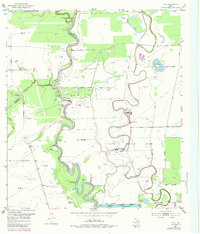
1953 Map of Otey
USGS Topo · Published 1984About this map
The Brazos River carves a deep, serpentine path through this Gulf Coast landscape, defining the boundary between Fort Bend and Brazoria counties. Much of the river’s eastern bend is occupied by the Ramsey State Prison Farm, a large agricultural and correctional tract featuring multiple facility hubs like Unit No 1 and Unit No 2. The industrial character of the mid-20th century is evident through the numerous Oil Wells and Gas Wells scattered across the floodplain, particularly north of the river’s oxbows.
Find a feature on this map
29 named features on this map. Tap any name to fly to it.
Don’t see what you’re looking for? This feature index may not catch every label — zoom into the map to look around manually.
Map Details
Editions of this 1953 Otey Map
4 editions found
Other maps of this area

1943 · Rosharon
USGS Topo · 1:31,680

1943 · Juliff
USGS Topo · 1:31,680

1943 · Angleton
USGS Topo · 1:24,000

1950 · Houston
USGS Topo · 1:250,000

1952 · West Columbia
USGS Topo · 1:24,000

1952 · East Columbia
USGS Topo · 1:24,000

1953 · Lake George
USGS Topo · 1:24,000

1953 · Damon
USGS Topo · 1:24,000

1953 · Otey
USGS Topo · 1:24,000

1953 · Thompsons
USGS Topo · 1:24,000