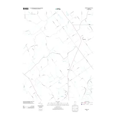
2013 Map of Otisco
USGS Topo · Published 2013About this map
The crossroads of Otisco and Marysville define this Clark County landscape, showing the persistent rural settlement patterns of southern Indiana in the early twenty-first century. This portion of the state is characterized by a dense network of country lanes and creeks, where small rural hubs are linked by thoroughfares like Marysville Rd and New Market Rd. Natural drainage defines the topography, with Silver Creek winding through the western portion while Fourteenmile Creek snakes across the southeast. Smaller tributaries such as Sinking Fork, Sugar Run, and Clegg Creek create a rolling geography punctuated by private water bodies like Marysville Lake, Shady Hollow Lake, and Jack-Pine Park Lake. The map details a transition from the historic village center at Nabb to the newer rural residential developments found along Hiddenview Farm Rd and Charlestown New Market Rd, providing a clear record of local property boundaries and modern road alignments.
Find a feature on this map
93 named features on this map. Tap any name to fly to it.
Don’t see what you’re looking for? This feature index may not catch every label — zoom into the map to look around manually.
Map Details
Editions of this 2013 Otisco Map
This is the sole edition of this map. No revisions or reprints were ever made.
Other maps of this area

1905 · Prospect
USGS Topo · 1:62,500

1912 · Prospect
USGS Topo · 1:62,500

1937 · Charlestown
USGS Topo · 1:24,000

1938 · Owen
USGS Topo · 1:24,000

1938 · Speed
USGS Topo · 1:24,000

1947 · Speed
USGS Topo · 1:24,000

1947 · Scottsburg
USGS Topo · 1:24,000

1948 · Owen
USGS Topo · 1:24,000

1949 · Henryville
USGS Topo · 1:24,000
1950 · Charlestown
USGS Topo · 1:24,000