
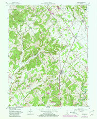
1956 Map of Otisco
USGS Topo · Published 1957About this map
The Clark Military Grant defines the geometric landscape of this mid-century survey, where diagonal property lines clash with the standard township and range system. This peculiar surveying legacy, a result of Revolutionary War land bounties, creates a jagged patchwork of woodlots and farms centered around the rail villages of Otisco, Marysville, and Nabb. The Baltimore and Ohio railroad corridor serves as the primary spine of the region, linking these small clusters of settlement.
Find a feature on this map
31 named features on this map. Tap any name to fly to it.
Don’t see what you’re looking for? This feature index may not catch every label — zoom into the map to look around manually.
Map Details
Editions of this 1956 Otisco Map
3 editions found
Other maps of this area

1905 · Prospect
USGS Topo · 1:62,500

1912 · Prospect
USGS Topo · 1:62,500

1937 · Charlestown
USGS Topo · 1:24,000

1938 · Owen
USGS Topo · 1:24,000

1938 · Speed
USGS Topo · 1:24,000

1947 · Speed
USGS Topo · 1:24,000

1947 · Scottsburg
USGS Topo · 1:24,000

1948 · Owen
USGS Topo · 1:24,000

1949 · Henryville
USGS Topo · 1:24,000
1950 · Charlestown
USGS Topo · 1:24,000