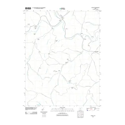
2010 Map of Otway
USGS Topo · Published 2010About this map
Otway stands as a focal point in the valley where Scioto Brush Creek meets the South Fork Scioto Brush Creek, defined by its historic Otway Bridge and central Otway Post Office. The surrounding terrain is a network of named ridges and hollows, such as Oswego Ridge and Honey Hollow, which provided the framework for scattered rural homesteads and family cemeteries. These burial grounds, including the Beech Fork Cemetery and Oswego Cemetery, are tucked away along winding routes like Tick Ridge Koenig Hill Rd and Big Spruce Little Bear Rd.
Find a feature on this map
85 named features on this map. Tap any name to fly to it.
Don’t see what you’re looking for? This feature index may not catch every label — zoom into the map to look around manually.
Map Details
Editions of this 2010 Otway Map
This is the sole edition of this map. No revisions or reprints were ever made.
Other maps of this area

1915 · Garrison
USGS Topo · 1:62,500

1915 · Otway
USGS Topo · 1:62,500

1916 · Peebles
USGS Topo · 1:62,500

1917 · Otway
USGS Topo · 1:62,500

1918 · Garrison
USGS Topo · 1:62,500

1918 · Peebles
USGS Topo · 1:62,500

1919 · Vanceburg
USGS Topo · 1:62,500

1949 · Pond Run
USGS Topo · 1:24,000

1949 · Vanceburg
USGS Topo · 1:62,500

1949 · Friendship
USGS Topo · 1:24,000