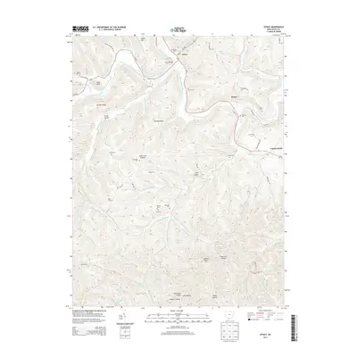
2013 Map of Otway
USGS Topo · Published 2013About this map
Otway sits at the confluence of several prominent waterways, including Scioto Brush Creek and Bloody Run, serving as a central hub for the surrounding rural landscape in Scioto County. The map reveals a high density of family-named cemeteries such as Garvin Cem, Thornton Cem, and Oppy Cem, suggesting a deep-rooted genealogical history tied to the local valleys and ridges. Transportation through the area follows the natural terrain, with Oh-73 and Oh-348 winding alongside the creeks, crossing the Otway Bridge to connect small settlements like Henley and Lombardsville. To the south, the terrain becomes increasingly complex around Bear Cr Lake and the Copperhead Lookout Tower, where the landscape is carved by numerous forks of Bear Cr and Pond Cr. The distribution of features like Buttermilk Hollow and Honey Hollow highlights a traditional naming convention that reflects the agricultural and natural character of this part of southern Ohio.
Find a feature on this map
80 named features on this map. Tap any name to fly to it.
Don’t see what you’re looking for? This feature index may not catch every label — zoom into the map to look around manually.
Map Details
Editions of this 2013 Otway Map
This is the sole edition of this map. No revisions or reprints were ever made.
Other maps of this area

1915 · Garrison
USGS Topo · 1:62,500

1915 · Otway
USGS Topo · 1:62,500

1916 · Peebles
USGS Topo · 1:62,500

1917 · Otway
USGS Topo · 1:62,500

1918 · Garrison
USGS Topo · 1:62,500

1918 · Peebles
USGS Topo · 1:62,500

1919 · Vanceburg
USGS Topo · 1:62,500

1949 · Pond Run
USGS Topo · 1:24,000

1949 · Vanceburg
USGS Topo · 1:62,500

1949 · Friendship
USGS Topo · 1:24,000