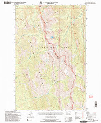
1995 Map of Our Lake
USGS Topo · Published 1997About this map
Bob Marshall Wilderness and the Lewis and Clark National Forest dominate this high-elevation landscape, where the continental divide marks a stark boundary between watersheds. This 1995 revision captures a wilderness preserved for its primitive character, centered on the glacial cirque containing Our Lake. High points like Rocky Mountain and Old Baldy overlook a complex drainage system including the South Fork Teton River and Ray Creek. The map documents administrative infrastructure within the forest, notably the Administrative Corral and Tack Shed and the Bear Top Lookout, which served as critical vantage points for forest management. The presence of the South Fork Teton-Blacktail National Recreation Trail illustrates the mid-1990s focus on primitive recreation and foot travel through the Sawtooth Range.
Find a feature on this map
30 named features on this map. Tap any name to fly to it.
Don’t see what you’re looking for? This feature index may not catch every label — zoom into the map to look around manually.
Map Details
Editions of this 1995 Our Lake Map
2 editions found
Other maps of this area

1903 · Saypo
USGS Topo · 1:125,000

1955 · Choteau
USGS Topo · 1:250,000

1957 · Choteau
USGS Topo · 1:250,000

1958 · Choteau
USGS Topo · 1:250,000

1958 · Ear Mountain
USGS Topo · 1:24,000

1958 · Cave Mountain
USGS Topo · 1:24,000

1958 · Porphyry Reef
USGS Topo · 1:24,000

1958 · Mount Wright
USGS Topo · 1:24,000

1958 · Our Lake
USGS Topo · 1:24,000

1958 · Glenn Creek
USGS Topo · 1:24,000