
1953 Map of Oviedo SW
USGS Topo · Published 1955About this map
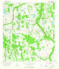
The Little Econlockhatchee River and its larger counterpart, the Econlockhatchee River, wind through this landscape of the early 1950s, defining a region of interconnected wetlands and numerous small lakes. This mid-century survey captures the rural character of eastern Orange County before the acceleration of suburban development. The Cheney Highway serves as the primary east-west artery, connecting the small settlements of Cheney and Bithlo. Local life is anchored by family landmarks and community nodes such as Rouse Cem, Downey Ch, and the Union Park Sch. The map reveals a high density of named water bodies, including Lake Rouse, Lake Georgia, and Lake Price, illustrating the complex drainage patterns and the significant role of surface water in shaping early Florida homesteads and infrastructure.
Find a feature on this map
24 named features on this map. Tap any name to fly to it.
Don’t see what you’re looking for? This feature index may not catch every label — zoom into the map to look around manually.
Map Details
Editions of this 1953 Oviedo SW Map
4 editions found
Other maps of this area

1953 · Narcoossee NE
USGS Topo · 1:24,000

1953 · Pine Castle
USGS Topo · 1:24,000

1953 · Geneva
USGS Topo · 1:24,000

1953 · Narcoossee NW
USGS Topo · 1:24,000

1953 · Bithlo
USGS Topo · 1:24,000

1955 · Orlando
USGS Topo · 1:250,000

1956 · Oviedo
USGS Topo · 1:24,000

1956 · Orlando East
USGS Topo · 1:24,000

1957 · Orlando
USGS Topo · 1:250,000

1958 · Orlando
USGS Topo · 1:250,000