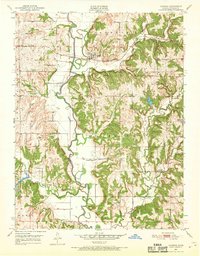
1951 Map of Ozawkie
USGS Topo · Published 1969About this map
The Delaware River meanders through Jefferson County, defining the agricultural landscape of Ozawkie and the surrounding townships of Fairview and Kentucky. This mid-century survey documents the area shortly after the 1948 aerial mapping, capturing a rural network of country schools like Hayes Sch and Lowry Sch before the consolidation of rural districts. A significant historical marker is the North Boundary Old Delaware Reservation, which cuts across the terrain, preserving the jurisdictional history of the Kansas territory. Local landmarks such as the Olive Branch Cem and Liberty Ch serve as touchstones for genealogists tracing family roots in this river valley. The landscape is further characterized by drainage features like Little Slough and Rock Creek, which feed into the primary river system that dominates the central valley.
Find a feature on this map
22 named features on this map. Tap any name to fly to it.
Don’t see what you’re looking for? This feature index may not catch every label — zoom into the map to look around manually.
Map Details
Editions of this 1951 Ozawkie Map
5 editions found

Other maps of this area

1886 · Oskaloosa
USGS Topo · 1:125,000

1888 · Oskaloosa
USGS Topo · 1:125,000

1889 · Topeka
USGS Topo · 1:125,000

1894 · Oskaloosa
USGS Topo · 1:125,000

1894 · Topeka
USGS Topo · 1:125,000

1949 · Williamstown
USGS Topo · 1:24,000

1949 · Perry
USGS Topo · 1:24,000

1950 · Perry
USGS Topo · 1:24,000

1950 · Kansas City
USGS Topo · 1:250,000

1950 · Williamstown
USGS Topo · 1:24,000