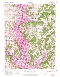
1951 Map of Ozawkie
USGS Topo · Published 1971About this map
The Delaware River valley dominates this landscape, showing a significant transformation as the newly formed Perry Reservoir inundates the lowlands. This 1970 photorevised update documents the expansion of the water level across the former floodplains of Slough Creek and Rock Creek, marking a pivot point for the community of Ozawkie. While much of the valley was submerged for flood control and recreation, traces of the area's earlier rural character remain on the higher ground.
Find a feature on this map
24 named features on this map. Tap any name to fly to it.
Don’t see what you’re looking for? This feature index may not catch every label — zoom into the map to look around manually.
Map Details
Editions of this 1951 Ozawkie Map
5 editions found

Other maps of this area

1886 · Oskaloosa
USGS Topo · 1:125,000

1888 · Oskaloosa
USGS Topo · 1:125,000

1889 · Topeka
USGS Topo · 1:125,000

1894 · Oskaloosa
USGS Topo · 1:125,000

1894 · Topeka
USGS Topo · 1:125,000

1949 · Williamstown
USGS Topo · 1:24,000

1949 · Perry
USGS Topo · 1:24,000

1950 · Perry
USGS Topo · 1:24,000

1950 · Kansas City
USGS Topo · 1:250,000

1950 · Williamstown
USGS Topo · 1:24,000