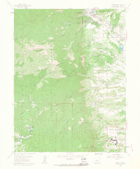
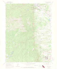
1961 Map of Palmer Lake
USGS Topo · Published 1963About this map
Palmer Lake sits at the foot of the Rampart Range, serving as a focal point where the mountain front meets the plains during this early 1960s survey. The landscape is defined by the dual infrastructure of the Denver and Rio Grande Western and Atchison Topeka and Santa Fe railroads, which parallel Monument Creek as they track south toward Colorado Springs. The southern portion of the sheet reveals the expanding United States Air Force Academy, featuring the iconic Chapel, Planetarium, and extensive Athletic Fields. Local history is preserved in markers such as the McShane Home (Site) Old Stone Fort and the Monument Nursery Headquarters. The western heights within the Pike National Forest are punctuated by dramatic landmarks like Elephant Rock, Raspberry Mountain, and the Ice Cave, while the southern reaches show high-altitude water bodies including Columbine Lake and Aspen Lake.
Find a feature on this map
60 named features on this map. Tap any name to fly to it.
Don’t see what you’re looking for? This feature index may not catch every label — zoom into the map to look around manually.
Map Details
Editions of this 1961 Palmer Lake Map
7 editions found
Other maps of this area

1893 · Platte Canyon
USGS Topo · 1:125,000

1893 · Colorado Springs
USGS Topo · 1:125,000

1894 · Pikes Peak
USGS Topo · 1:125,000

1894 · Castle Rock
USGS Topo · 1:125,000

1901 · Pikes Peak
USGS Topo · 1:125,000

1901 · Pikes Peak
USGS Topo · 1:62,500

1909 · Colorado Springs
USGS Topo · 1:125,000

1913 · Castle Rock
USGS Topo · 1:125,000

1942 · Colorado Springs
USGS Topo · 1:125,000

1948 · Colorado Springs
USGS Topo · 1:62,500