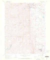
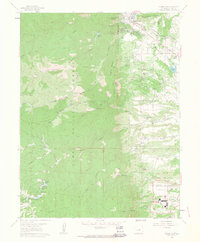
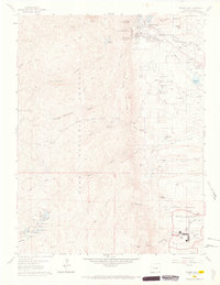
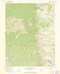
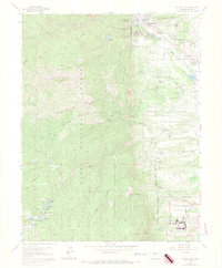
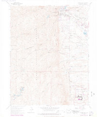
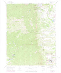
1961 Map of Palmer Lake
USGS Topo · Published 1970About this map
The town of Palmer Lake serves as a focal point where the eastern plains meet the dramatic rises of the Pike National Forest. In this early 1960s landscape, the mountain backdrop is defined by peaks such as Sundance Mountain and Raspberry Mountain, while the valley floor shows a complex transportation network with both the Denver and Rio Grande Western RR and the Atchison Topeka and Santa Fe RR traversing the area near Monument Creek.
Find a feature on this map
58 named features on this map. Tap any name to fly to it.
Don’t see what you’re looking for? This feature index may not catch every label — zoom into the map to look around manually.
Map Details
Editions of this 1961 Palmer Lake Map
7 editions found
Other maps of this area

1893 · Platte Canyon
USGS Topo · 1:125,000

1893 · Colorado Springs
USGS Topo · 1:125,000

1894 · Pikes Peak
USGS Topo · 1:125,000

1894 · Castle Rock
USGS Topo · 1:125,000

1901 · Pikes Peak
USGS Topo · 1:125,000

1901 · Pikes Peak
USGS Topo · 1:62,500

1909 · Colorado Springs
USGS Topo · 1:125,000

1913 · Castle Rock
USGS Topo · 1:125,000

1942 · Colorado Springs
USGS Topo · 1:125,000

1948 · Colorado Springs
USGS Topo · 1:62,500