1961 Map of Palmer Lake
USGS Topo · Published 1969About this map
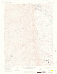
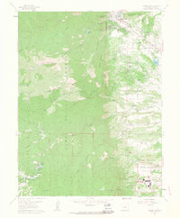
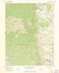
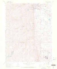
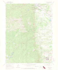
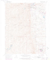
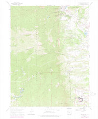
Palmer Lake sits at the foot of the Rampart Range, serving as a focal point where the mountain front meets the plains and the northern campus of the United States Air Force Academy. This 1961 field-checked survey illustrates the dual character of the region: a high-altitude recreational and residential landscape to the north and the structured, institutional layout of the academy grounds to the south. The academy area includes detailed footprints for the Planetarium, Athletic Fields, and the distinctive Chapel, alongside specialized infrastructure like the Heating Plant.
Find a feature on this map
64 named features on this map. Tap any name to fly to it.
Don’t see what you’re looking for? This feature index may not catch every label — zoom into the map to look around manually.
Map Details
Editions of this 1961 Palmer Lake Map
7 editions found
Other maps of this area

1893 · Platte Canyon
USGS Topo · 1:125,000

1893 · Colorado Springs
USGS Topo · 1:125,000

1894 · Pikes Peak
USGS Topo · 1:125,000

1894 · Castle Rock
USGS Topo · 1:125,000

1901 · Pikes Peak
USGS Topo · 1:125,000

1901 · Pikes Peak
USGS Topo · 1:62,500

1909 · Colorado Springs
USGS Topo · 1:125,000

1913 · Castle Rock
USGS Topo · 1:125,000

1942 · Colorado Springs
USGS Topo · 1:125,000

1948 · Colorado Springs
USGS Topo · 1:62,500