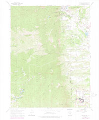
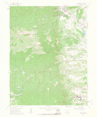
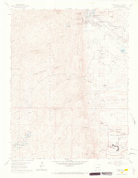
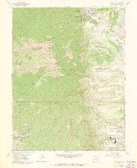
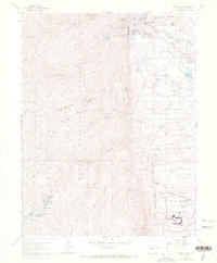
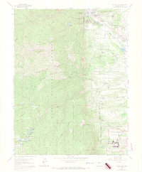
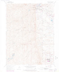
1961 Map of Palmer Lake
USGS Topo · Published 1977About this map
Palmer Lake sits at the base of the Front Range, where the high plains meet the steep eastern slopes of the Rockies. This geography is defined by a dense network of mountain streams including Limbaugh Canyon and North Monument Creek, alongside prominent geological formations like Elephant Rock and Monument Rock. The southern portion of the map reveals the institutional development of the era, dominated by the United States Air Force Academy campus, complete with its Chapel, Planetarium, and Parade Ground.
Find a feature on this map
58 named features on this map. Tap any name to fly to it.
Don’t see what you’re looking for? This feature index may not catch every label — zoom into the map to look around manually.
Map Details
Editions of this 1961 Palmer Lake Map
7 editions found
Other maps of this area

1893 · Platte Canyon
USGS Topo · 1:125,000

1893 · Colorado Springs
USGS Topo · 1:125,000

1894 · Pikes Peak
USGS Topo · 1:125,000

1894 · Castle Rock
USGS Topo · 1:125,000

1901 · Pikes Peak
USGS Topo · 1:125,000

1901 · Pikes Peak
USGS Topo · 1:62,500

1909 · Colorado Springs
USGS Topo · 1:125,000

1913 · Castle Rock
USGS Topo · 1:125,000

1942 · Colorado Springs
USGS Topo · 1:125,000

1948 · Colorado Springs
USGS Topo · 1:62,500