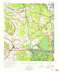
1970 Map of Palmetto
USGS Topo · Published 1972About this map
St Landry Parish and Pointe Coupee Parish are defined by the intricate hydrology of the Atchafalaya River and its sprawling spillways. This era reveals a landscape transitioning from traditional bayou settlements like Rideau Settlement and Waxia to an industrializing corridor shaped by the Missouri Pacific RR and expanding energy interests. The southern portion is anchored by Port Barre, where the Bayou Teche begins its course amidst a network of sloughs and prongs.
Find a feature on this map
76 named features on this map. Tap any name to fly to it.
Don’t see what you’re looking for? This feature index may not catch every label — zoom into the map to look around manually.
Map Details
Editions of this 1970 Palmetto Map
This is the sole edition of this map. No revisions or reprints were ever made.
Other maps of this area

1935 · Osca Bayou
USGS Topo · 1:62,500

1939 · Opelousas
USGS Topo · 1:62,500

1939 · Fordoche
USGS Topo · 1:62,500

1940 · Arnaudville
USGS Topo · 1:62,500

1941 · Batchelor
USGS Topo · 1:62,500

1948 · Bunkie
USGS Topo · 1:62,500

1952 · Lake Charles
USGS Topo · 1:250,000

1954 · Lake Charles
USGS Topo · 1:250,000

1954 · Baton Rouge
USGS Topo · 1:250,000

1955 · Osca Bayou
USGS Topo · 1:62,500