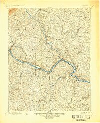
1897 Map of Palmyra
USGS Topo · Published 1945About this map
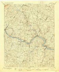
The James River and Rivanna River converge in this late nineteenth-century survey, defining the industrial and transportation corridors of Central Virginia. The Chesapeake and Ohio railroad follows the winding northern bank of the James, connecting riverfront settlements like Scottsville, Bremo Bluff, and Columbia. This era highlights the area's geological wealth, anchored by the Arvonia Slate Quarry south of the river, a site that became a major source of architectural slate. Inland, the landscape is dotted with established plantation sites and crossroads such as Palmyra, the county seat, and the milling community at Union Mills. Further south, the Willis River and Slate River drain the Piedmont hills, where small outposts like New Canton and Fork Union were becoming important local nodes. The map captures a transitional moment when river navigation was yielding to rail power while the traditional rural hierarchy of tavern-centered junctions and water-powered mills remained intact.
Find a feature on this map
97 named features on this map. Tap any name to fly to it.
Don’t see what you’re looking for? This feature index may not catch every label — zoom into the map to look around manually.
Map Details
Editions of this 1897 Palmyra Map
7 editions found

Other maps of this area

1887 · Spottsylvania
USGS Topo · 1:125,000

1890 · Goochland
USGS Topo · 1:125,000

1891 · Palmyra
USGS Topo · 1:125,000

1891 · Farmville
USGS Topo · 1:125,000

1892 · Buckingham
USGS Topo · 1:125,000

1892 · Appomattox
USGS Topo · 1:125,000

1892 · Spottsylvania
USGS Topo · 1:125,000

1892 · Goochland
USGS Topo · 1:125,000

1892 · Gordonsville
USGS Topo · 1:125,000

1892 · Harrisonburg
USGS Topo · 1:125,000