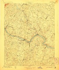
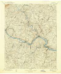
1897 Map of Palmyra
USGS Topo · Published 1907About this map
Palmyra serves as the central hub of this late 19th-century landscape, situated where the Rivanna River cuts through the heart of Fluvanna County. The topography reveals a complex network of waterways feeding the larger basins, with the Hardware River and Slate River defining the drainage patterns of the surrounding Piedmont. Industrial activity is anchored by the Arvonia Slate Quarry in the south, while the Chesapeake and Ohio Railroad follows the northern bank of the river through Bremo Bluff, connecting riverside communities like Columbia and Scottsville to broader markets. The distribution of small settlements such as Union Mills, Fork Union, and Bells Cross Roads reflects a rural economy deeply tied to both the river valleys and the emerging rail infrastructure that began to bypass older water-reliant trade routes.
Find a feature on this map
106 named features on this map. Tap any name to fly to it.
Don’t see what you’re looking for? This feature index may not catch every label — zoom into the map to look around manually.
Map Details
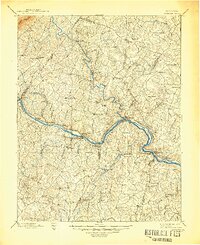
Editions of this 1897 Palmyra Map
7 editions found

Other maps of this area

1887 · Spottsylvania
USGS Topo · 1:125,000

1890 · Goochland
USGS Topo · 1:125,000

1891 · Palmyra
USGS Topo · 1:125,000

1891 · Farmville
USGS Topo · 1:125,000

1892 · Buckingham
USGS Topo · 1:125,000

1892 · Appomattox
USGS Topo · 1:125,000

1892 · Spottsylvania
USGS Topo · 1:125,000

1892 · Goochland
USGS Topo · 1:125,000

1892 · Gordonsville
USGS Topo · 1:125,000

1892 · Harrisonburg
USGS Topo · 1:125,000