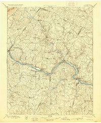
1897 Map of Palmyra
USGS Topo · Published 1929About this map
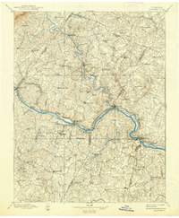
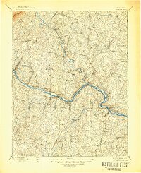
James River and Rivanna River corridors define this Central Virginia landscape, captured during a late-19th-century survey. The terrain is a network of ridges and watercourses, anchored by the Chesapeake and Ohio RR as it follows the northern bank of the James. Industry of the era is evident at the Slate Quarry near Arvonia, while agricultural and commercial centers like Scottsville and Palmyra serve as regional hubs. The presence of several rural processing sites, including Aldridge Mill, Trenton Mills, and Flanagan Mills, indicates a dispersed river-driven economy before the widespread electrification of the countryside. To the north, the map shows the rugged eastern slopes of Carter Mountain and the intricate drainage of Byrd Creek and Mechunk Creek, illustrating the complex topography that historically influenced settlement patterns and road placement between Albemarle and Goochland counties.
Find a feature on this map
103 named features on this map. Tap any name to fly to it.
Don’t see what you’re looking for? This feature index may not catch every label — zoom into the map to look around manually.
Map Details
Editions of this 1897 Palmyra Map
7 editions found

Other maps of this area

1887 · Spottsylvania
USGS Topo · 1:125,000

1890 · Goochland
USGS Topo · 1:125,000

1891 · Palmyra
USGS Topo · 1:125,000

1891 · Farmville
USGS Topo · 1:125,000

1892 · Buckingham
USGS Topo · 1:125,000

1892 · Appomattox
USGS Topo · 1:125,000

1892 · Spottsylvania
USGS Topo · 1:125,000

1892 · Goochland
USGS Topo · 1:125,000

1892 · Gordonsville
USGS Topo · 1:125,000

1892 · Harrisonburg
USGS Topo · 1:125,000